
Start with things to do, then shape the rest of your visitLog In
Everything to do on your South Padre Island visit.
SouthPadreInfo.com — one place, explained.

coastal place guide

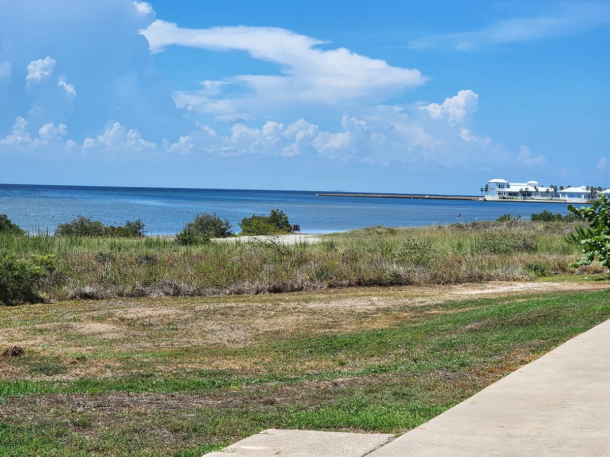
Laguna Madre bayside

A researched visitor guide to Laguna Madre bayside and its access, setting and practical considerations.

2.1 Marisol (Laguna Madre) Boat Ramp
  • Official name — Marisol (Laguna Madre) Boat Ramp. The city uses the parenthetical

"(Laguna Madre)" consistently in its press material; locals may simply say the Marisol ramp.

  • Jurisdiction / operator — City of South Padre Island, Shoreline Department [5][6].
  • Location — 1705 Laguna Boulevard, South Padre Island, TX 78597 [6].
  • How to reach it — paved road; Laguna Boulevard runs parallel to and west of Padre Boulevard.

Designed for vehicles towing trailers.

  • Parking — truck and trailer spaces are part of the built project [5][6]. The city has not

published a space count as of 2026-09-02.

  • Fees / hours / seasonality — **not published by the City of South Padre Island as of

2026-09-02.** No launch fee, gate hour or seasonal restriction appears in either the
groundbreaking or the grand-opening release. Treat as unknown, not as free.

  • Amenities — a fish-cleaning station, and a loading/attendant dock built to be ADA accessible,

set alongside the ramp [5][6]. Restrooms, showers, shade, trash, bike racks, picnic tables,
playground: none published. No lifeguard or Beach Patrol presence — this is a launch, not a
swimming area.

  • Vehicles on sand — not applicable; this is a hardened ramp, and the city prohibits motor

vehicles on its beaches generally [2].

  • Camping — none published; the city prohibits overnight camping on its beaches [2].
  • Rules specific to this spot — none published by the city as of 2026-09-02. State boating and

seagrass law applies (§7).

  • Hazards — shallow, seagrass-floored water immediately outside the ramp; propeller contact

with seagrass is a state offence (§7). Trailer traffic and the Laguna Boulevard approach.

  • Nearest food / water — commercial Padre Boulevard is one block east; the city publishes

nothing about on-site water.

  • Why it matters — the city describes this as the first public bay-access development it has

built in thirty years, funded roughly three-quarters by a U.S. Treasury RESTORE Act Direct
Component grant and a Texas Parks & Wildlife boating-access grant, on a total project cost of
about $3.22 million [6][7]. Groundbreaking was 1 October 2025; the grand opening was held
21 July 2026 [5][6].

  • Sources — [2][5][6][7]
2.2 Cora Lee Drive bay street end
  • Official name — the city's grant paperwork calls it the Cora Lee Bayside Public Access; on

the ground it is the west end of W. Cora Lee Drive.

  • Jurisdiction / operator — City of South Padre Island [3].
  • Location — W. Cora Lee Dr, South Padre Island, TX 78597; the city gave coordinates

26.125909, -97.174486 and described the site as a bay street-ending public access point [3].

  • How to reach it — paved residential street, walk-in at the end. No trailer launch.
  • Parking — not published by the city as of 2026-09-02 (street parking only, so far as any

city document shows).

  • Fees / hours / seasonality — the city described the access as free and continuing in public

use; no gate, fee or hours are published [4].

  • Amenities (as of April 2021) — the city's own description of then-existing conditions was

three large wooden stairs down to the tide line, a sloped earth trench used to launch kayaks, and
two public benches [4]. ⚠ This is a 2021 snapshot. The city's 2026 projects page lists only
Fantasy Circle (a Gulf access) as recently completed and does not say whether the Cora Lee
improvements were ever built [8]. No restrooms, showers, lifeguard, pavilion or playground has
ever been published here.

  • Vehicles on sand — no.
  • Camping — no.
  • Rules specific to this spot — none published.
  • Hazards — an earth launch and stairs to a tidal shoreline; shallow water; the same seagrass

and boat-traffic issues as the rest of the lagoon (§7).

  • Nearest food / water — Padre Boulevard businesses, a few blocks east.
  • Why it matters for board sports — the city itself states that Cora Lee is a popular

windsurfing and kiteboarding spot, and that a street ending makes it easy to rig gear and get
into the bay; the island's windy spring and autumn are the reason [4]. The proposed project
(a floating dock, a proper kayak launch, an equipment loading zone, removal of concrete riprap,
a deck for benches and a stormwater drain pipe) was aimed at non-motorised use — kayaks,
windsurfing and kiteboarding [4].

  • Sources — [3][4][8]
2.3 The other bayside street ends — what the city does and does not publish

The city's 2026 Shoreline projects page states that a bayside living-shoreline feasibility study,
run with the Texas General Land Office, covers ten bayside street endings, undertaken because
of erosion [8]. **The city does not publish which ten they are, nor a list, map or guide of bay
accesses**, as of 2026-09-02:

  • The Beach Access Guide and Beach Access Parking Guide PDFs are Gulf-only. Searched in

full, neither contains the words "bay", "Laguna", "kayak" or "boat" anywhere; the guide runs
from the Pearl and La Copa accesses through Harbor Circle #1 to Whitesands Circle #25 [9][10].

  • The city's Map Viewer publishes seven maps — Beach Access, Area Attractions, City Facilities,

Boat Ramps, County Parks, City Parks and Piers. There is no bay-access map [11].

  • The Shoreline Department's Beach Accessibility page counts 28 beach access points, 19 with

parking, 400+ spaces and 30+ accessible spaces — all Gulf-side figures, with no bayside
equivalent [12].

So: bayside street ends exist, the city maintains them and studies them, but a visitor cannot get
a published list of them from the city. That is a genuine gap, not an oversight in this research.

2.4 Laguna Madre Nature Trail
  • Official name — Laguna Madre Nature Trail.
  • Jurisdiction / operator — city-associated; the contact number published for it is the City of

South Padre Island main line, (956) 761-3000 [13]. **⚠ The city's own site does not describe this
trail**; the only description found is the city convention-and-visitors-bureau listing, so this
entry is MEDIUM confidence.

  • Location — 7355 Padre Boulevard, i.e. on the Convention Centre grounds, coordinates

26.1408241, -97.1752165 [13].

  • How to reach it — walk-in from the Convention Centre grounds; paved approach.
  • Parking — the Convention Centre lot. No dedicated count published.
  • Fees / hours / seasonality — **not published by the City of South Padre Island or its CVB as

of 2026-09-02.** Blog and review sites assert it is free and open around the clock; none of them
is an acceptable source and no official page says so, so this stays a gap.

  • Amenities — a 1,500-foot boardwalk crossing four acres of marshland, planted to attract

coastal and migratory birds [13]. Restrooms, showers, ADA specifics, shade, trash, bike racks,
picnic tables, playground: none published.

  • Vehicles on sand / camping — no.
  • Rules specific to this spot — none published.
  • Hazards — boardwalk over tidal marsh; mosquitoes and sun exposure are the obvious ones but

are not officially posted.

  • Nearest food / water — Convention Centre and Padre Boulevard.
  • Is there sand? — No. This is elevated boardwalk over wetland; there is no beach and no

swimming access.

  • Sources — [13]
2.5 South Padre Island Birding, Nature Center & Alligator Sanctuary
  • Official name — South Padre Island Birding, Nature Center & Alligator Sanctuary; commonly

shortened to the Birding Center [14].

  • Jurisdiction / operator — a non-profit that its own site says was created by the town's

Economic Development Corporation [15]. It is not a city department, though the city's Shoreline
Department links to it as a volunteering partner [16].

  • Location — 6801 Padre Boulevard, South Padre Island, TX 78597 [17]. It sits on the bay side,

a short distance north of the Convention Centre.

  • How to reach it — paved road, ordinary car park.
  • Parking — on site; no published count.
  • Fees / hours (as of 2026-09-02) — open daily 8:00 a.m. to 5:00 p.m.; adults $15, seniors 65+

$10, military $10, students $10, children aged 4–12 $5; closed Thanksgiving, Christmas Day and
Easter Sunday [17]. ⚠ Contested: the city CVB's listing still shows the June 2025 schedule of
$12 adult / $10 concession / $5 child [14]. The operator's own page is the later and more
authoritative of the two; budget for $15.

  • Amenities — the operator advertises over 3,300 feet of boardwalk [18]; the CVB listing

describes about three-quarters of a mile of boardwalk through 43 acres of coastal wetland, five
shaded bird blinds with seating, butterfly gardens, a five-storey observation tower over the
Laguna Madre, an alligator sanctuary holding more than fifty rescued animals, a tortoise
sanctuary, an exhibit room and a gift shop [14]. Restrooms are implied by a staffed visitor
centre but are not itemised in either source.

  • Vehicles on sand / camping — no.
  • Rules specific to this spot — paid admission; guided tours are booked separately [14].
  • Hazards — live alligators in an enclosure; boardwalk over wetland.
  • Nearest food / water — on-site gift shop sells snacks and drinks [14]; Padre Boulevard

otherwise.

  • Is there sand or water access? — No. Boardwalk and tower only; no launch, no swimming.
  • Sources — [14][15][16][17][18]
2.6 South Padre Island Convention Centre grounds
  • Official name — South Padre Island Convention Center (the city also uses "Convention

Centre" in some material).

  • Jurisdiction / operator — City of South Padre Island.
  • Location — 7355 Padre Blvd., coordinates 26.1410463, -97.1751285; the CVB classifies it in

its "Bayside" region [19].

  • How to reach it — paved road at the north end of the developed island.
  • Parking — a large lot. The city was running a paving project on the Convention Centre lot and

an expansion programme; no public space count is published.

  • Fees / hours — the building is an events venue; grounds access is not ticketed, but the city

publishes no hours for the grounds as of 2026-09-02.

  • Amenities — 45,000 sq ft of meeting space, a 22,500 sq ft exhibit hall, a 2,633 sq ft

auditorium seating 230, 9,000 sq ft of breakout space, and an outdoor Sunset Terrace off the
lobby facing the lagoon [19]. The Laguna Madre Nature Trail begins here (§2.4).

  • Vehicles on sand / camping — no.
  • Is there a bay beach or launch here?No official source says so. The grounds front the

Laguna Madre and the terrace looks out over it, but neither the city nor the CVB publishes any
swimming area, sand beach, boat ramp or kayak launch on the Convention Centre property. Widely
repeated claims that the flats immediately north of the Convention Centre are the kiteboarding
and windsurfing spot could not be confirmed from any official page; the only official statement
the city makes about a board-sports launch names Cora Lee, which is roughly 1.5 km south
of the Convention Centre, not north [4][13][19]. See §Gaps.

  • Sources — [4][19]
2.7 Bay-adjacent city parks with no water access

Three city parks touch the wetland side of the island but offer views rather than access. All are
described on the city's Parks and Recreation page [20]:

  • Queen Isabella Memorial Park — in the median near the crossover at the foot of the Queen

Isabella Causeway. It holds the memorial to the victims of the 2001 causeway collapse and a
bronze statue of Padre Balli. No water access, no facilities published.

  • South Padre Island Gateway Project — a set of decks overlooking the wetland around the

island's entrance, presented by the city as a viewpoint. No water access.

  • Lis Memorial Park — a pocket park on W. Esperanza, a bench overlooking a wetland area.

Dedicated 2016. No water access.

Also on the city's list, though Gulf-facing: Pickleball Park (610 Padre Blvd), Joe Buck and Mary Jo
Camp Islands Legend's Park at Laguna Boulevard and W. Huisache (under a $300,000 rebuild in 2026,
half-funded by a TPWD grant), John L. Tompkins Park (6100 Padre Blvd), Turtle Park (E. Morningside)
and Butterfly Park (4316 Gulf) [20]. Legend's Park is on Laguna Boulevard but is a neighbourhood
playground, not a bay access.

2.8 Wind and Water Sports Venue (planned, not open)

The Shoreline Department's projects page states that groundbreaking for a Wind and Water Sports
Venue was scheduled for the end of July 2026, and describes it as a bayside park that will provide
parking and bay access for several kinds of activity [8]. **As fetched on 2026-09-02 the page still
reads as a scheduled groundbreaking**, and the city has published no location, no opening date and
no facility list. Do not describe it as open or under construction. This is the single most likely
thing to change on the bay side in the next year.

2.9 Boat ramps shown on city maps — read with caution

The city's Map Viewer "Boat Ramps" layer carries six markers: Amberjack Boat Ramp, Jim's Pier Boat
Ramp, Parrot Eyes Boat Access, Polaris Boat Ramp, KOA Boat Ramp and Palm Street Pier Boat Ramp [11].
**Every marker has an empty description, the marker identifiers date from around 2011, and the new
Marisol ramp is absent**, so the layer is stale. Several of the names are businesses (a pier, a
campground, a bar-restaurant), and the city does not state which if any are public. Treat this list
as a set of leads, not as a directory of public ramps.

Separately, the city's Grants section carries a 2016 document-centre entry titled "Restore Act -
Corral Street Boat Ramp" [21]. The entry has an official date of 2016-03-02 and no content.
Whether a Corral Street ramp was ever built, and whether it is public, is unresolved — do not
assert that it exists.

---

Check before you go

Road, beach, tide and park conditions can change quickly. Follow posted signs and verify current local-government notices before a long drive or any beach-driving plan.